
Reflecting society through cartography
Adventurers love them, explorers devise them, and everyone uses them - maps.
From cave paintings to ancient maps of Babylon, Greece, and Asia, through the Age of Discovery (15th – 17th century) up until today, people have created and used maps as the essential tools to help them define, explain, and navigate their way through the world.
Many old maps are beautifully illustrated and have been transformed into exquisite works of art. These illustrated maps sometimes help with giving insights into a society or culture, certainly through content and sometimes even through artistic style.
European maps from the 13th century for example, used illustrations to show important places linked with Christian mythology and history, as well as other imaginative pictures in less important places.
During the 17th and 18th century printed maps included vignettes, cartouches, heraldry of the social elites, images of monarchs or themes from Greek mythology, religion, or religion geography as illustrations. Below we highlight some stunning maps with impressive illustrations that look like works of art.
 Illustrated Queen on a map of Europe, 1788. Public Domain | Rijksmuseum
 Coast of Sweden between Kalmar and Stockholm, 1580. Public Domain | Rijksmuseum
 Spain and Portugal, 1703. Public Domain | Rijksmuseum
 North of Italy, 1702. Public Domain | Rijksmuseum
 Coasts of Flanders, Normandy and England, 1580. Public Domain | Rijksmuseum
 English coast between the Isle of Wight and Dover, 1580. Public Domain | Rijksmuseum
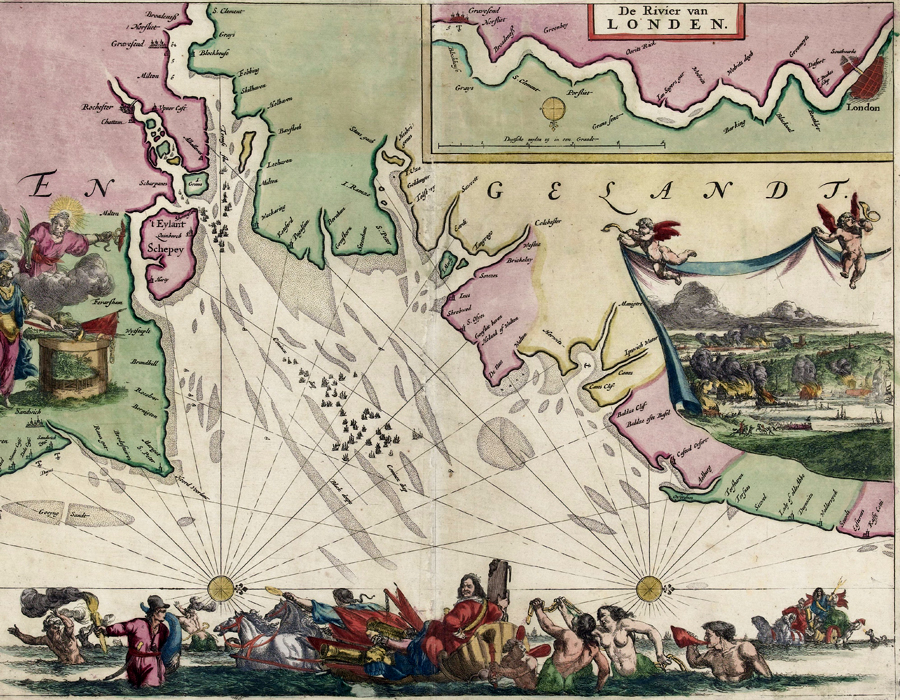 Map of Thames Estuary with the trip to Chatham, 1667. Public Domain | Rijksmuseum
 Russian coast at the town of Kola, 1597. Public Domain | Rijksmuseum
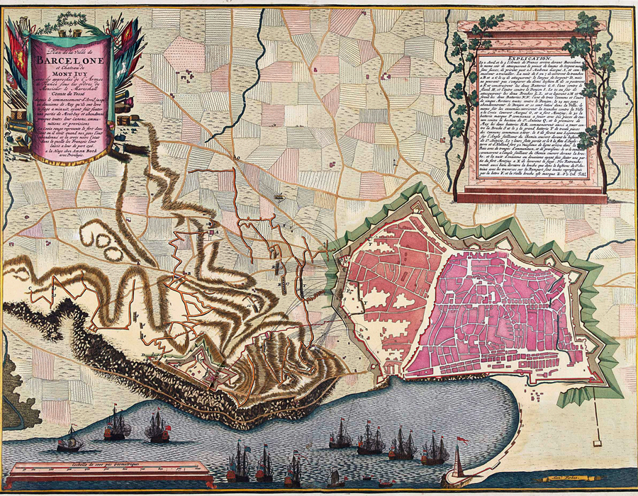 Map of the siege of Barcelona, 1706. Public Domain | Rijksmuseum
 Vignette on a map of Central America, 1694. CC-BY